Dave, Jackie, Richard, and Ferg hike the CPR Trail from Cameron Lake up Mt. Arrowsmith.
Posted by davidjgilbert in British Columbia, fitness, Hiking, Port Alberni, training on February 2, 2016

Our first view point, just as the sun was emerging. Our big dog, Xhosa, was left at home today as she’s been limping and she needed some rest.
It’s been very dark and wet in Port Alberni so when our friend Richard called and suggested hiking up Mt. Arrowsmith we jumped at it! And a nice rare clear day too!
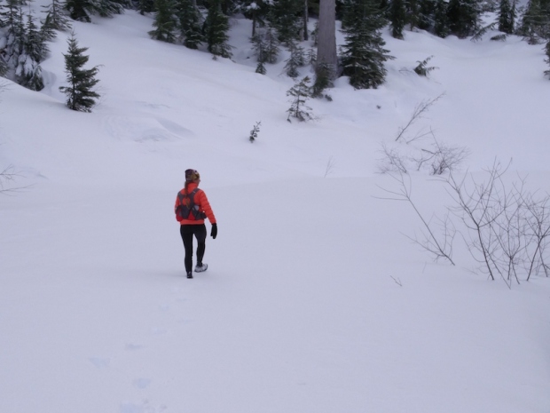 This is a 1000 metre climb, and since Jackie is in training for an upcoming race, she opted to go with her full water bottle vest she is trialling. As you can see, the trail is not easy to find when everything is covered in snow.

Ferg has cold nose and feet!
The scenery was very nice being snow covered once we got high enough. We saw fresh cougar tracks crossing our trail about half way up.

Richard Ronyecz knows this area well. Good thing, because you couldn’t see much of the trail.
There was no snow at the Cameron Lake trailhead, but after a couple of hundred metre elevation gain the snow started and got deeper and deeper until it was about a metre deep with higher drifts.

Scenic up high.

Fergus loves the snow! He was really tough for such a little guy – we were out there for nearly five hours.
We ended up, at the far side of the loop, not being able to clearly find the track. So we took the safe option, rather than risk wasting 15 minutes at a time, over and over again trying to find the trail, and just retraced our tracks back down. A very fun and beautiful day.
And if you have a couple of minutes and want a laugh, check out this video of Fergus (Yorkie-Chihuahua cross), with icebergs hanging off his fur, after four hours of hiking through the snow, still full of energy and having a good play:
Day 1 of the Kalahari Augrabies Extreme Marathon – people dropping from the heat!
Posted by Jacqueline Windh in Africa, events, International, South Africa, ultramarathon on November 9, 2015
{This is my Kalahari ultramarathon report originally published on SleepMonsters. For an overview of what this one-week race is, check out my previous post] “This year will be the real race,” RD Estienne Arndt said to me at the start line. He was referring to last year’s KAEM, when racers didn’t get the full Kalahari Desert experience due to unseasonably cool temperatures and even a few days of rain. In contrast, today’s temperatures were predicted to sit around the mid 40s (well above 100 F), and those conditions are expected to hold for the entire week.
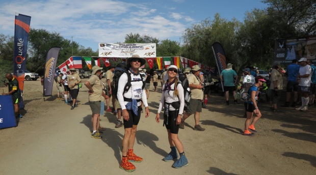
Dave and me at the start line.

And we’re off! Mostly dirt roads, but some cross-country.
It was already very hot as 70 of us set off from the start line at 9am. Starts for the rest of the week will be earlier. Today’s route was by far the easiest route of the week, though – only 25 km, with little elevation gain, rising 100 m over the first half then dropping 200 m over the second half. Those elevation changes may seem trivial to you, but out here in the sun they translate to serious issues of heat management. Even a tiny uphill raises your body temperature, so having the gentle downhill for the later (and hottest) part of the route was a very good thing.
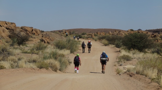
The group is not too spread out yet. Many of us taking it very easy because of the heat.

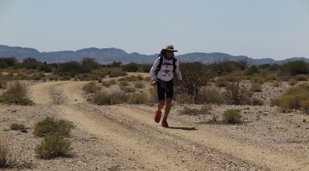
Approaching our first aid station!
Aid stations were around 8 km apart, so there were two along the route before the finish. Dave and I had been advised to take this day as a training day, and to acclimatize, and we took that seriously. We were well down towards the back of the pack, but we managed ourselves really well. We made the first aid station in around 1:20, so managed to sustain a decent jog/walk pace. Shortly after, we passed a pair of guys from Austria, Josef and Ambros. Josef was obviously in trouble, having knee issues. As we approached the second aid station, Ambros caught up with us jogging, and told us that Josef had dropped out. Shortly after, we passed a 4WD with some of the medical crew, giving a woman an IV.
Less than 10% into this race, and already conditions were taking their toll.
We did run a bit – but mostly we took it very slow.
The route, however, was spectacular – in some places due to the starkness, wide open plains with a few sparsely scattered shrubs. In other areas, traversing rounded granite outcrops, winding our way through dry stream beds (soft sand and no wind, VERY hot but very pretty) and over bare rock hills. We were especially thrilled to see a herd of five giraffe a short distance from the track, less than an hour from the start.
Dave and I kept up our very conservative and relaxed pace. The heat was affecting Dave quite a bit, so we took our time at the second aid station, giving him a chance to cool down. The volunteers here are amazing, many them who have come back many times over the years.
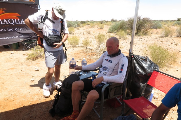
Dave is not looking his best.
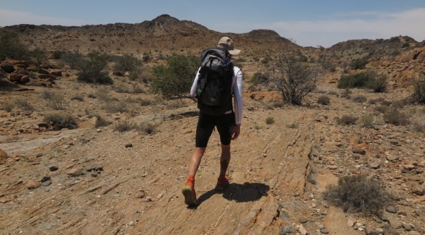
It was noon when we left this aid station, and Dave was having a lot of trouble keeping his body temperature down, so we stopped a few times for him to try to cool down. It’s hard to find a good place to stop – the low hilltops had a good breeze but no shade, and the shrubby trees were located only in the dry river beds – stiflingly hot and sandy, and no breeze at all.
Nice scenery – when we remembered to enjoy it!
Dave wasn’t sure he would be able to finish the race at this point…
The last part of the route followed a very hot and narrow dry stream bed, enclosed by rock walls. We rounded a spectacular gap flanked by giant granite boulders, and there was Camp 1 set up – most of the field already here, relaxing in the shade in the gazebos. The temperature here in the shade was 48C, which means out there in the sun and on the hot sun it must have been well into the 50s.

Wejust rounded this boulder – and there was camp! Phew!
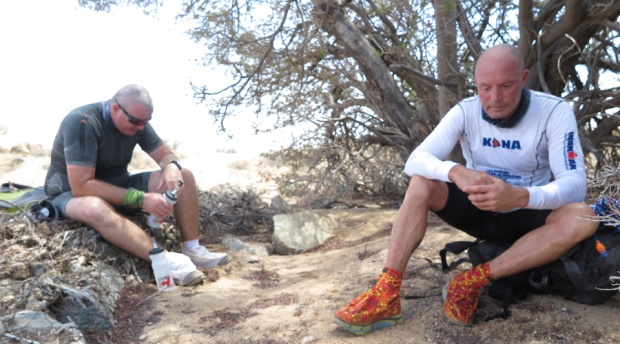
That heat definitely took its toll. I don’t have any final results or info, but I heard upon my arrival that 4 racers had pulled out so far. Ambros, in the next gazebo over from me, has been wailing with insufferable cramps, and got carted away by the medical crew for an IV. (Rules here are that you are allowed one IV – if you need a second, you are out).
Edward Chapman of the UK, here for his ninth time, was still well behind us. When he came in, after 6 hours on the course, he expressed concern for his friend Michelle. He had been feeling unwell and had stopped in the shade, so she should be ahead of him – but she had never arrived. Estienne immediately sent out a search crew. As I am writing this, Estienne has just returned to say that they found Michelle unconscious on the track several km out from here, so she also is out.

This is what camp looks like. And what we do here.
He has also informed us that the route will be altered tomorrow because of this heat. The distance will remain the same, but the section between CP2 and CP3 will be changed from “Death Valley” which has no vehicle access, to a more road-accessible route. As Estienne put it, if any other people drop from heat stroke, he needs to be able to get to them quickly by vehicle. I am really glad that they have such excellent safety procedures in place here – it was really clear to all of us today that the heat can kill very quickly, if you end up off track and run out of water.
Prepping for Kalaharai Augrabies Endurance Marathon – our first self-supported staged ultramarathon
Posted by Jacqueline Windh in Africa, events, International, races, South Africa, ultramarathon, wildlife on November 8, 2015
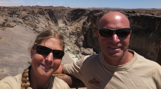 In October, Dave and I raced the Kalahari Augrabies Extreme Marathon. The race is named for where it takes place: in Augrabies Falls National Park, in the Kalahari Desert, eastern South Africa along the border with Namibia. We’ve both raced multi-day staged ultramarathons before, but this would be our first self-supported race.
 Self-supported means you must carry your own gear – in other words, carry a fairly heavy pack. In addition to the week’s worth of food, we also had to carry all of our clothing for the week (some racers opted for almost no clothing other than what they raced in – yuck!), sleeping bags and mats, and dishes. Race organizers provided hot water (so freeze-dried instant meals were the go) as well as canvas shelters for us to sleep under. Anything else was up to us.

Monkeys showing their stuff. Yup,umm, those are what you think they are…
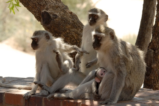
Cute little monkey family. (I think they are laughing at those boys).

This is the restaurant at Augrabies – frequented by colourful birds and these little dassies.
We were expecting heat – but by the week before the race, the forecast was looking scary! Day-time temperatures for race week forecast to hover around 40°C, or 105°F (and it ended up getting WAY hotter than that). We had been warned about very cold night-time temperatures here, so my husband Dave and I both brought our down jackets. Ha ha,that ended up being a joke.
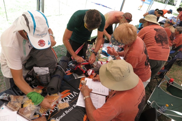
Compulsory gear check – if we didn’t have all of the required gear, including at least 2000 calories of food per day, we were not allowed to race.
This year’s event had 71 racers entered, 34 of them from South Africa, and the remainder (just over half the field) coming from around the globe: elsewhere in Africa, the Middle East, a great number from Europe, three from Canada (including Dave and me) and one each from Australia and the USA.
Figuring out nutritional needs – packing enough, but not too much, not to mention the right balance of foods – was a challenge. I was carrying enough for close to 3000 calories per day, which ended up being more than I needed. However, I would rather err on that side, than go hungry at the end of a tough week in the Kalahari Desert!

Testing out our sand gaiters – some by ar.co.za and some by Rough Country. They velcro on to the bottoms of the shoes, to keep all sand out (major blister prevention strategy).
Some runners had their packs down to around 7 kg dry weight. Dave’sand mine both came down to 12 kg. We were okay with those weights starting out – not wanting to be missing stuff and suffering out there – but by the end of the race we both had learned so much that we would be able to go way lighter next time. Aid stations were 8-10 km apart, and we were provisioned with 1.5 l of water at each, so we would be carrying up to 1.5 kg of water on top of that dry weight.
Dave and I trained with our weighted packs for only a few weeks before the race. I think I would have been better training with the heavy pack a bit longer than that, as it does put a different type of strain on your joints and your feet – but overall, I was feeling pretty good pre-race.
Planned daily distances were: 25k, 30k, 40k, 80k (overnight stage), 47k, and 21k.
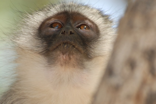
There were monkeys in our camp/race headquarters at Kalahari Augrabies National Park, and nice short walks to view the waterfalls and gorge. Dave and I went out on a two-hour game drive the afternoon before the race (I feel I should be resting – but I cannot resist seeing more of Africa and its wildlife, not to mention get an idea of the terrain we would be passing through). On the drive, we saw eland, springbok and a giraffe!

Heading out on our pre-race game drive.

A chance to get a look at the country we would be running through. Not a lot of shade.

Herd of eland.
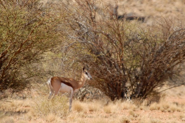
A springbok.

Our first giraffe!

Another lovely view of the gorge.
Return to Stellenbosch – more wine-tasting!
Posted by Jacqueline Windh in Uncategorized on November 1, 2015
 Dave and I had enjoyed Stellenbosch so much on our way east, that we regretted having already booked our next night’s accommodation at Kleinbaai. But no worries! We hadn’t booked the next two nights, so we could easily turn around and come back through here again on our way back west, to Cape Town, so that’s what we did.
On our first trip through, we hit a couple of wineries, then headed east to the coast via the Franszhoek mountain pass. This time, after our Gansbaai hike, we scootled back to Stellenbosch that afternoon via the scenic coast road. I had the whole trip precision-timed: how far we could go on the Gansbaai hike before having to turn around, and what time we needed to be back in the car and on the road, in order to make it back to Stellenbosch in time to visit one winery before they closed.
We already had a map of all of the wineries, and the owners at our previous accommodation had kindly circled the ones that they highly recommended. The one that (a) was on their recommended list and (b) was on our route into town and (c) would be open that day was Blaauklippen – so there we headed.
One of the many lovely things about the Stellenbosch wineries is that they are all so different. Wine-tasting here is a bit different from what I am used to in other parts of the world. You generally have to pay for tastings here – but then they are a more formal and drawn-out experience, where you sit down and have five different glasses poured for you, which you enjoy in a leisurely way, one by one. Do not plan on hitting four or eight wineries in a day!
Blaauklippen, like all of the wineries here, is in a stunningly beautiful setting – the vineyards backed by rocky mountains. The tasting area was a casual sitting area outside, and the staff were very friendly and knowledgeable.

Arriving at Blaauklippen.

Such history in this part of South Africa – both here at Stellenbosch and at Constantia, it was amazing to visit wineries that are over three centuries old.

We each could choose a completely different selection of wines to taste – whites, rosés, reds and sparkling! (And then taste each other’s picks, too)
One of the other reasons that we had wanted to go back to Stellenbosch was because of its amazing “steakhouse” – the Hussar Grill – which takes such care of the meat, the waiters telling you how many days each of the cuts of beef has been hanging, and offering a great selection of wild African game meats there. The first time there I had kudu, which was exquisite – like the tenderest and tastiest beef you have ever had. This time Dave had ostrich. Another amazing night, enjoying great foods and very fine yet affordable wines (no plonk!).
The next morning, sadly, was our last here. We had a 2pm flight to Johannesburg, and from there, the next day we would be flying east to Upington, for our race in the Kalahari Desert. But the Cape Town airport is only about a half-hour drive from Stellenbosch… so we were able to get to one more winery before flying out. We selected Asara – with a more formal tasting room overlooking the wine barrel storage room (I am sure there is a better name for that…) which also doubles as a ballroom, with a fancy chandelier and space to lay out grand dining table down the central corridor.

The tasting room at Asara.

Wouldn’t you LOVE to attend a dinner here?
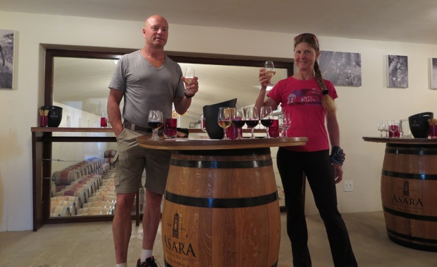
Well, at least we got to enjoy the wines here…

The grounds here were lovely too – and there is accommodation on-site.

Enjoying our last view of Stellenbosch, before whizzing off to catch our flight.
Klipgat Trail hike, Gansbaai to DeKelders, South Africa
Posted by Jacqueline Windh in Africa, Hiking, South Africa, Uncategorized on October 29, 2015
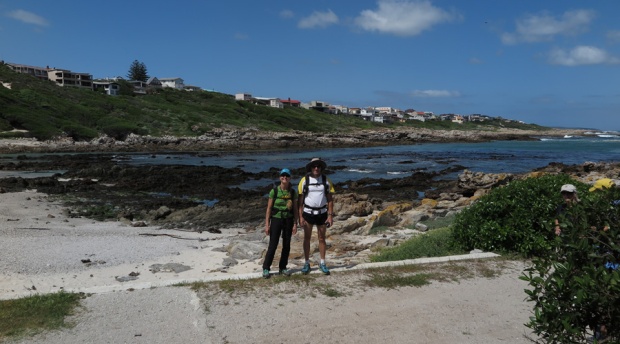
 Well, we had spent a lot of time in the car this past week. And on planes for a few days before that. Not great training for our Kalahari race, which was now only days away. We had loved Stellenbosch so much on our way through, that we decided we would stop here again on our way back to Cape Town. But we would stop and do a coastal hike from the village of Gansbaai first, before heading inland. A good chance for us to get some exercise, as well as to test our gear.
This was a real eye-opener of a hike – a great chance to see what towns back home like Tofino and Port Alberni could do with waterfront lands if they planned ahead a bit. The whole 7 km hike is along a narrow strip of shoreline, nearly all of it with residential land backing it. But the shoreline itself – the beaches and the rocky headlands and the cliffs – is all public land, and the trail that passes over here is beautiful.

The day was quite warm – nothing like what we were expecting in the Kalahari, but still a lot hotter than what we were used to back home – so this was a pretty good training hike with our loaded packs. I was quite surprised to feel hot spots developing on my heels – precursors to blisters – which I guess was due to the hot weather and my sweaty feet. I had worn these same socks and shoes, with the loaded pack, many times at home with no problems at all. A good little warning, for being proactive about taping those areas before the race started.

Tortoises. They actually move pretty fast!
I’ll let the photos speak for themselves. This was a lovely hike, and there were whales just behind the break nearly the whole way. Dave and I really appreciated the chance to get a few hours of activity in, before getting back in the car to hurry off – our time in the Cape Town region was rapidly running out, and we wanted to get to at least one more winery in Stellenbosch today, before they closed.

Beautiful views of sea and coastal scrub the whole way.

We stopped for a quick core workout at one of the bays.

Mostly a coastal path, with infrastructure such as stairways where needed.
Just a thin strip of public land – but what a boon for the community!
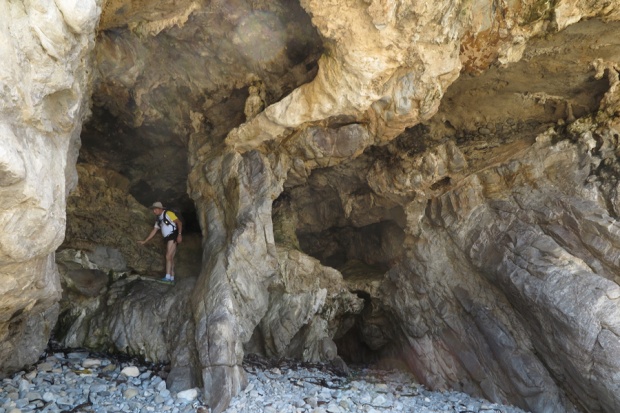
One optional descent along the way to some sea caves.

We went down by a stairway, but our route back up was a bit rough!

And this was the view pretty much the whole way… with whales feeding close to shore, just off the kelp beds. Great hike!
Kleinbaai to South Africa’s southernmost point, Cape Agulhas: birdwatching and whales!
Posted by Jacqueline Windh in Uncategorized on October 27, 2015
Heading east along the coast.
I had always believed that Cape of Good Hope was Africa’s southernmost point. But on this trip I learned that Cape Agulhas, a tiny bit to the south but much farther east, actually holds that claim to fame.
I’m glad that Dave and I didn’t plan to go any further east than Cape Agulhas. Planning our trip from home, everything looks so close together on the map. But once you get here, there are so many places you want to stop at.
We’d arrived at our B&B in Kleinbaai at nightfall the previous night, just in time to have dinner at the quirky pub just outside this tiny seaside village : the one and only place we experienced our whole time in Africa where the cheap wine really IS just cheap wine. (Everywhere else, it is cheap yet world-class). This was plonk! Terrible! (The food was good, though).
We started reasonably early the next morning, with our first stop at Pearly Beach, 10 km east of Kleinbaai. You don’t need to take a boat trip to enjoy the whale-watching here! We could have stayed here all day, watching the southern right whales feeding just off the kelp beds and just behind the beach break, some of them with calves.

Breaching southern right whale at Pearly Beach

Another southern right whale just off the kelp beds.
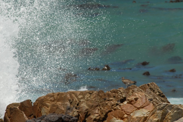
Our trip soon became a birdwatching expedition – first here at Pearly Beach, with sandpipers, whimbrels, and endangered African oystercatchers along the rocky shoreline.

Still working on ID-ing this guy, some sort of plover at Pearly Beach.

African black oystercatchers – endangered – nesting here.
A whimbrel watching the crashing surf. This is an amazing species – we have them here on Vancouver Island. Our birds go down to Central and South America for winter. This guy, here in South Africa, was most likely raised in northern Scotland! And will head back there to nest.
We finally forced ourselves back into the car to continue eastward, towards the cape -when I spied a tree alongside the road full of weaver nests. I forced Dave to pull over and back up, and we watched the birds, lovely yellow cape weavers chattering and hanging upside down from their suspended nests. Little did we know how many trees like that we would see in the coming miles!

A tree full of weaver nests!

Bickering weavers.
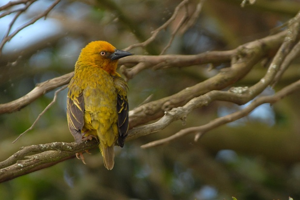
They are very pretty birds, though – these cape weavers.
We still had not had a chance to buy a bird book, so we had no idea of the names of the species we were observing. We ended up making up names for most of them – our own private birding language. When our route eventually veered on to gravel roads, a sparrow-sized bird with a tail about four times the length of its body flew alongside for us and finally landed. We called it the tailbird.

Now onto the dirt tracks – and some amazing birding.

Tailbird!! (Later ID’d as a pin-tailed whydah)
But the birding became much more spectacular than that… as we came across flocks of ostriches! We passed a lot of wetlands, with all sorts of wading birds and ducks and geese. I named one of the ducks we saw the white-faced whistling duck (because that’s what it looked like and that’s what it did)… and later learned that I had got it pretty much right!

Very pretty birds, these blacksmith lapwings.

And yes – ostriches!
A distant flock of spoonbills was one of the highlights of our day, along with a range of small birds in brilliant shades of yelllow, red and green (later identified as weavers, bishops, and a malachite sunbird), and several blue cranes: gorgeous graceful cranes with long wing feathers than blow in the wind, South Africa’s national bird.

Blue cranes are rare and endangered – but they were common down here.
With all of the birdwatching, it took ages for us to make it to the cape. We were starved by the time we stopped for lunch, at a little hole-in-the-wall fish and chips stand around Struisbaai.

Struisbaai – where lots of kids were playing in the warm ocean water.
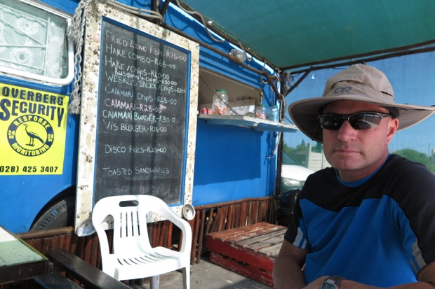
A limited lunch menu – but good security!
The cape itself was beautiful too, with some short walking trails around – a chance to stretch our legs after all the driving. The lighthouse here was constructed in 1848 – but by now it was already 5pm, and they were locking up so we couldn’t go in.

Walkway to Cape Agulhas.

And here we are at Cape Agulhas – southernmost point on the African continent. Not as spectacular as the Cape of Good Hope.

Nice birds at the cape, too – this is a Kittlitz’s plover (I think)

Cape Agulhas lighthouse…

…built in 1848.
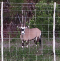
Later learned this is an oryx, or gemsbok – native further north.
The drive back was fun too… a few fenced-in areas that we figured out were private game farm. The animals must have been sleeping when we drove through the first time, but now they were moving around.
Dave screeched to a halt a few times: “Wow – what is that?” It’s fun being in Africa – like being a child again, with all of the new animal names and bird names still to learn.
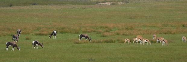
And these guys? Later learned – the bigger, darker ones are bontebok, these ones on a fenced-in reserve, but they were actually originally native to only a very small area right around here. I think the little guys are springboks – native to northeastern South Africa and Namibia, but not to this exact area.
We finished our night with a drink and dinner at the Great White Restaurant – named for the sharks that frequent this area. (No… we didn’t go swimming here).

Cocktails at the Great White – with a southern right whale skeleton suspended overhead.
Stellenbosch 1 – Tasting wines and olive oils
Posted by Jacqueline Windh in Africa, International, South Africa on October 25, 2015
 This post is labelled #1, because we only had one night booked in Stellenbosch and then were driving east along the coast – but we liked it so much there that we decided to pass through again on our way back. So there will be another post about our wine-tasting adventures around Stellenbosch coming.
 I’m going light on the text and heavy on the photos, because we are still travelling and I don’t want to spend all of my time on the computer. We first visited a winery called Tokara, that also grows olives, so we did an olive oil tasting there. (It was around 10 am… saving ourselves for wines later). Then we moved on to one called BabylonStoring, that also has huge vegetable gardens and orchards, with kilometres of trails. We wandered the gardens there for an hour or two, then had lunch and did a wine-tasting there, before hitting the road – through the wine-producing town of Franzshoek and over the mountains, to our next stop for the night back on the coast.
Tokara Vineyward and Olive Farm:


 Babylonstoring vineyard and gardens


 Hitting the road – from Stellenbosch, over Franzshoek Pass, and to the coast by sunset


Hiking Table Mountain, above Cape Town, South Africa
Posted by Jacqueline Windh in Africa, International on October 23, 2015
 One of the things on Dave’s “definite to-do list” for South Africa was to hike up Table Mountain. Of course I was happy to go along. What a surprise to find out that it rises more than 1000 m above the city of Cape Town!
There is a gondola that goes up to the summit, but of course we would rather walk. We took the Platteklip Gorge route, parking near the bottom of the gondola cable, and hiking from there. We had originally planned to stay in Cape Town only two nights, and to hike Table Mountain either our first or second day, before hitting the road and driving east along the coast.
But the weather wasn’t great for hiking – totally fogged in and windy on the mountain – and we were really enjoying the Cape Town area, and the places we could get to from here (that I’ve already blogged about: the Constantia wineries, and the Cape of Good Hope). And the forecast was looking much better a few days away – so we ended up staying a total of four nights in Cape Town, hiking up Table Mountain on our final day. And, as you will see from these photos, it was worth the wait. It was a stunning day!

Here’s where we parked. We are about to hike up to that pointy peak in the centre, which is where the gondola arrives to.

The start of the Platteklip Gorge Trail – one of the MANY routes up the mountain.

Frogs in the pond at the trailhead. We saw three frogs fighting, biting one another and rolling around. Who would have known?

A pretty steady climb. First view point, looking over Cape Town – only part way up.

Checking out the gorge…

…which the trail follows, to avoid the cliffs.

Partway up the gorge. Views getting ever better! You can see the road below, to get an idea of how far we have come up so far.

Now on top. We were surprised by how many trails there were up here. We decided to take the one to McClear’s Beacon, the highest point on the mountain (which really is very flat on top like a table), before heading back to the gondola for a ride down.

Trail on top to McClear’s Beacon.

Stopped for lunch at the beacon,with great views northward, then followed a different trail back, skirting the cliff edge on the west side, above our car.

Cliff-edge view over downtown Cape Town.

It’s spring here, and there were so many beautiful wildflowers in bloom up here.

Heathers.

(Not sure what these are).

And here’s a view of Lion’s Head, the peak we climbed the other day in the mist and fog – with no views!

Then back to the top of the gondola cable – a much busier place than where we had spent most of our day.

But still with gorgeous views – here looking down above Camp’s Bay. Check out the little rock ledge on the far left – can you see the little furry guy sun-baking there?

Here he is, closer up. He’s an animal called a dassie. Apparently his closest living animal relative is the African elephant. (I would have guessed guinea pig…)

And then the gondola ride down – a very fast trip!

Back to the car around 3pm – now finally leaving Cape Town and heading inland, to the world-famous wine-producing area of Stellenbosch. Blog post about that coming…
Finally! We made it to the Cape of Good Hope, South Africa
Posted by Jacqueline Windh in Africa, International on October 19, 2015
 Well, it took us a long time to get here. The first day, we were waylaid by the wineries at Constantia. Next day, we were delayed by a visit to World of Birds and then to the penguin colonies at Boulders. But, that second day, we kept driving south, and around mid-late afternoon we finally made it to the Cape of Good Hope.
It was 3 or 4 pm, and we hadn’t even had lunch yet. There was a funicular (slanted railway car going up the hill) to the lighthouse above, with a trail alongside. Dave had heard of an award-winning restaurant here called Two Oceans (because this is the place where the Indian and Atlantic Oceans meet – although it is not the southernmost point of Africa) and we thought it might be beside the lighthouse. So we hiked up there – hungry! – and the view was magnificent… but the signs to the restaurant allpointed down, back to where our car was parked.
So we hiked back down, and found the restaurant hidden at the back of the parking lot – but with a magnificent view of False Bay and the shorelines to the north and east (we were on the east side of the cape – the Indian Ocean side). Stopped there for a late lunch of the most tender calamari I have ever tried, and finally around 5pm headed out for our hike to the cape. Here are some pix:

View to the north fromthe lighthouse.

View westward from the lighthouse – that point behind the beach is the Cape of Good Hope.

At the restaurant.

Dave thought it was fun to feed the red-winged starlings from our table at the restaurant. Until he realized that the restaurant provided water spray bottles to shoot them with, to keep them off the dining tables – and suddenly Uncle Dave turned into the starlings’ worst enemy.

Nice view! We saw a fur seal from here, as well as a few mongoose-like mammals. We still don’t have a bird book or animal book, so we are kinda making up the names of the things we see as we go…

Five pm – lunch finally over with, and still an hour or two until sunset, we are finally heading out on a little hike.

A beautiful little beach below – wish we had more time.

View back eastward to the lighthouse. Turned out the lighthouse was too high – ships couldn’t see the light if it was foggy out – so they had to build a new one, lower down. You can just see the new one on the rocks, just above the horizon.

Surprise! We saw ostriches as we hiked to the cape!

View back east towards the lighthouse. The ostriches were on the flat green plateau on the upper left. If you can see any black dots there – that is them!

View from the Cape of Good Hope, downward and to the west. There is another parking lot down there. This now is the Atlantic Ocean (previous pix were the Indian Ocean).

Reptile. Lots of these guys. Since we don’thave a reptile book, I have named him the South African black alligator lizard.

Better ostrich views on the way back. There were small chicks, too – you just can’t see them in my photos. Sorry!

There was a little side-trail on our way out. You are supposed to be out of the park by sunset or you risk getting locked in (and we were still 10k from the gate) – but this would probably be our only time EVER coming here, and we wanted to take advantage of every moment. So we took the side-trail… and we saw our first whales from here! They are southern right whales. There was one right below us, here in the bay, just at the break, and several more further out to sea.

Heading back to our car…hmmm, this road was chockerblock full of cars here when we arrived.

Yup, definitely last car here. And definitely a very full day. We barely made it out of the park, arriving to the gate just as it was closing!
Visiting the African penguin colony at the Boulders, Simonstown
Posted by Jacqueline Windh in Uncategorized on October 18, 2015
 There is so much to do here, and it is so hard to figure out where to spend our time and what things to bypass. We’d already spent most of the first half of our day at World of Birds, and we wanted to make it all the way to the Cape of Good Hope this same day. But we would be driving right past the colonies of African penguins, near Simonstown. It would be a shame to bypass this – but if we stopped, we might not have much time at the Cape of Good Hope….
Well – who would drive past penguins? Of course we couldn’t! Their colonies are right on the edge of town, a stone’s throw from the highway. (In fact, there are signs on the highway warning you to lookout for penguins). It’s part of the national park system, and very well managed. We paid our entrance fee and had a quick walk around…. don’t have time to write much, we’re trying to get back on the road – but here are some pix!

The whole area is boardwalk – so visitors have great opportunities to get very close to the penguins, yet the birds are not disturbed by our presence at all.

It’s near the end of the nesting season, so there were lots of big fat chicks around.

Here, the parent is regurgitating to feed the chick.

The site is right on the ocean. The penguins can walk from the beach up to their nesting sites in the dunes. Here are both fluffy grey chicks and blackand white adults.

Lots of them resting on the beach. So nice to be able to see them so close.

Really fun birds to watch.
This was a really worthwhile stop. But we didn’t have much time left to spend at Cape of Good Hope. So we got into the car and started driving – our last chance to see the point where the Indian and Atlantic Oceans meet! Next blog post will describe that!
